.jpg)
.jpg)

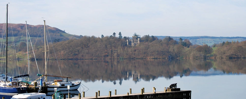
WRAY CASTLE (Photo over Windermere to Wray Castle).
Owned by the National Trust, it is not a real castle, but a private house built in the Gothic Revival Style in 1840. The grounds are open to the public and the house itself is open during the summer months. From the Castle front there is a breathtaking view towards Lake Windermere and fells beyond.
(Please note: we do not accept any responsibility for errors or changes in the route described – an up to date Ordnance Survey map should always be used in conjunction with the route description)
 Blelham Tarn/Wray Castle Lake District walk
‘With the inclusion of Wray Castle and the Lake Windermere shore walk, this walk has just about everything.’
4.5 miles. Stout shoes or boots recommended.
A circular valley walk from the village of Outgate through woods and open countryside with some stunning views of the central fells
From the Outgate Inn walk out of the village towards Ambleside (north) as you leave the village you will find a bridleway on your right. (Don’t be confused by an earlier footpath on the right). Take the bridleway, which leads into the woods on a good if somewhat rough path. From the path there is good view of Latterbarrow to the right.
As you approach Blelham Tarn you will reach a path junction, go straight forward here signed – Low Wray/Wray Castle
Follow the bridleway past the Tarn on your right for about 1 mile before exiting onto a quiet lane. Turn right, and after the entrance to Wray Campsite you will reach the castle gatehouse on the left.
Route 1:
Turn left here and follow the path down to Wray Castle NT – grounds open all year – the house has limited opening. Opposite the entrance to the house watch out for some steps on the left leading down to a path, go down the steps and follow the path to junction.
Turn left signed – Wray Boat House/Lakeshore.
At the lakeshore turn right, signed High Wray Bay, and follow the shore first through woods and then through pasture.
At the junction with a bridleway turn right, signed Wray Church/Castle Gate House, follow the bridleway, which after about 300 yds leads you, back to the lane adjacent to entrance to the castle.
Turn left after a 100 yds watch out for the footpath on your right.
Route 2:
Go past the entrance to the castle for further 100 yds before a footpath on the right is reached.
Take the path through the fields. Cross a slate bridge over a stream, and then bear left following the field edge and intermittent yellow marker arrows. Go through several stiles before reaching a cottage on the right. Go through the gate past the cottage and up the lane ahead.
At the top of the lane turn right towards High Tock Farm, signed, Loanthwaite/Hawkshead/Outgate. At the farm bear left, again following the yellow markers, up the slope to a stile and path junction. Go over the stile and follow the wall, signed Low Wray. Drop down to a gate and turn left, signed Outgate.
Follow the path, which is a little indistinct in places, through the fields, at one stage crossing a small stream at a ford. There are several gates/stile before you reach a path junction. Turn right here and follow the path back into Outgate.
Images copyright A2A Advertising Ltd